NSW fishing guide
Botany Bay Fishing Licence 2026: NSW Fee, Georges River Closures and Kurnell Checks
Botany Bay anglers use the NSW Recreational Fishing Fee or exemption pathway, then check Sydney South rules, Georges River closures, shellfish status and park access.
Parent guide: NSW Fishing Licence Guide 2026: Fees, Exemptions and Official Service NSW Links
On this page
Botany Bay licence check
Botany Bay does not have its own local fishing licence. The purchase question is the NSW Recreational Fishing Fee: most adults fishing, crabbing, prawning, bait collecting, hand gathering, spearfishing or carrying fishing gear near NSW waters need the fee unless an official exemption applies.
Buy through Service NSW and choose the official short-term or longer option for the dates you will fish. If you are exempt, carry the proof NSW requires instead of buying a receipt you do not need.
Choose your Botany Bay pathway
| Botany Bay trip | Licence or fee answer | What to check next |
|---|---|---|
| Adult shore fishing from beach, wharf or rock edge | Pay the NSW Recreational Fishing Fee unless exempt. | Sydney South guide, saltwater limits and FishSmart. |
| Boat fishing from Botany Bay or Georges River | Pay the NSW fee unless exempt. | Closed waters, boating access, port signs and weather. |
| Under 18 or official exemption holder | Fee may not be required. | Carry proof and still follow every rule. |
| Crabbing, prawning or bait collecting | The NSW fee can still apply to the activity. | Local closed-water map, permitted methods and shellfish status. |
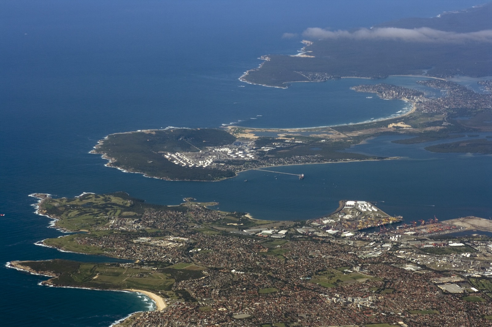
| Fishing near Kurnell, La Perouse or Kamay Botany Bay National Park | Do not rely only on the fee receipt. | Park access, local signs, rock safety and mapped boundaries. |
| Towra Point or seagrass-flat trip | Treat it as a sensitive boundary check. | Towra Point reserve information, FishSmart and current closures. |
Local rule layer
Use Botany Bay as a NSW saltwater and estuary rules lookup with an extra Sydney South layer. The official Botany Bay and Georges River closed-waters map is the local source to open before you keep fish, collect bait, set crab gear or move from one bank to another.
| Local check | Why it matters |
|---|---|
| Botany Bay and Georges River closed waters | Some mapped waters can be closed or method-restricted even when the wider bay is open. |
| FishSmart map | Boundaries around reserves, bridges, park edges and local closures are easier to check on the official map. |
| Shellfish status | Oysters, mussels, cockles and other shellfish need current Food Authority status before harvesting. |
| Kurnell and La Perouse access | Fishing legality and foreshore access are separate; follow park, port, ramp and local signs. |
| Rock and beach conditions | A valid NSW fee receipt does not make a swell, wash zone or channel edge safe. |
Do not copy Sydney Harbour seafood or closure advice across to Botany Bay. They are nearby Sydney waters, but the official local layers are different.
Species, gear and seafood checks
Before keeping catch, open NSW saltwater bag and size limits for the exact species. Botany Bay catches can include common estuary and coastal species, but the legal answer comes from the live NSW tables, not from local habit or tackle-shop memory.
Methods also matter. Prawning, trapping, bait collecting, hand gathering and spearfishing can trigger the NSW fee requirement and local method rules. If the plan involves anything beyond ordinary rod-and-line fishing, check permitted and prohibited saltwater methods before carrying the gear.
Seafood is a separate decision. For shellfish, start with NSW Food Authority recreational seafood advice and the current shellfish harvest area status. After heavy rain, pollution reports or visible discoloured water, use NSW Health recreational water guidance before wading, collecting bait or planning to eat catch.
Parks and access
Kamay Botany Bay National Park and Towra Point Nature Reserve add an access layer around parts of the bay. Those pages are not a substitute for DPIRD fishing rules, but they help with entry points, closures, protected areas, tracks, beaches and visitor safety.
If your spot is close to a reserve boundary, port area, airport edge, ferry wharf, bridge, navigation channel or signed swimming area, pause and check the map rather than guessing from the shoreline.
Buying and proof
Use Service NSW for the fee receipt and keep digital or paper proof available. The NSW fee can cover the payment requirement statewide for its valid period, but local rules still change by water.
A Botany Bay plan should not be copied to Sydney Harbour, Jervis Bay, Lake Macquarie or a freshwater dam without a separate rule check. The right sequence is: NSW fee or exemption, Sydney South guide, Botany Bay and Georges River map, FishSmart, method rules, shellfish status and the exact access layer for your spot.
Frequently asked questions
Do I need a fishing licence for Botany Bay?
Most adults need the NSW Recreational Fishing Fee unless an official exemption applies. Botany Bay does not use a separate local licence.
Is Botany Bay covered by Sydney Harbour rules?
No. Use the NSW Sydney South material, FishSmart and the Botany Bay and Georges River closed-waters map rather than copying a Sydney Harbour checklist.
Can I collect oysters or other shellfish in Botany Bay?
Only use current NSW shellfish and closed-water advice. Botany Bay planning should include the Food Authority shellfish status page before any shellfish harvesting.
Can I fish inside Kamay Botany Bay National Park or Towra Point?
Fishing rules, park access and reserve boundaries are separate checks. Use NSW National Parks information and FishSmart before fishing around Kurnell, La Perouse or Towra Point.